GeoPicSorter by Aldo Franquez

This page is focused on giving instructions on how to use GeoPicSorter. You may click the screenshots to enlarge them (open in a new tab).

Usage instructions

Before using the tool, it's recommended to create a separate folder with a copy of all the pictures you wish to sort, in order to test the tool's usability.

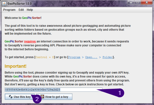
To get started, open GeoPicSorter by double-clicking the downloaded JAR, this window should show up:
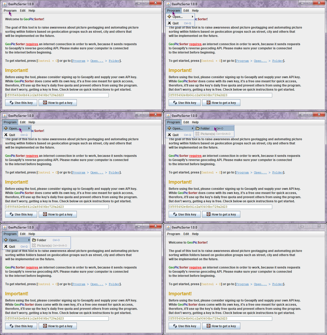
Go to the Program menu, select Open... and finally Folder, you can also just use the Control + O shortcut.
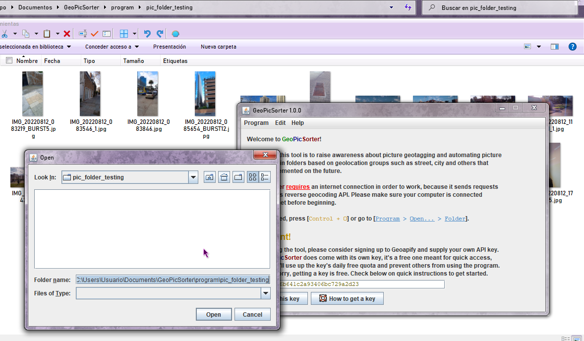
You'll see a folder selector like the one above, it's normal no files show up in it, this is how Java works. So select the folder where you have any unsorted pictures.
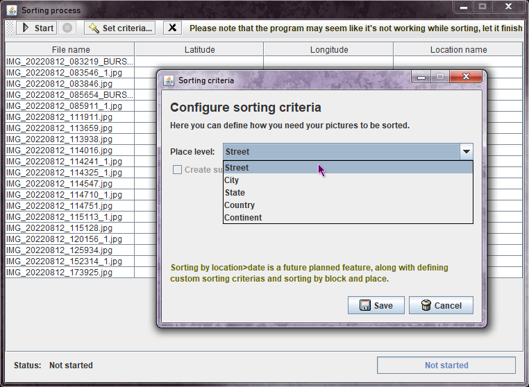
A window listing all of the detected files will show up, please note that only .jpg pictures were tested so far, as such, this is the only format that'll be detected.
Optionally, you can click the Set criteria... button to define the sorting criteria to use, the default is by street.

Once you're ready, press Start and wait for the program to finish, there's no proper visual indication yet to let you know how's the process coming along, so please wait until the data shows up at the table, as shown in the screenshot below:
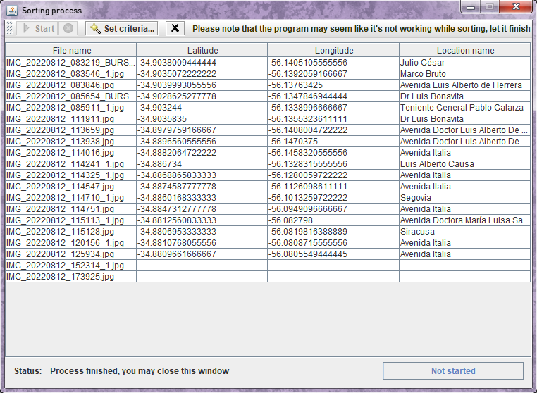
When you're done, you can close this window and repeat the process, or close the tool.

If you look into the folder where you used GeoPicSorter, you'll see the pictures have been copied to one or more sub-folders. GeoPicSorter detects when a picture doesn't have geolocation data, or has it but the API that translates the coordinates doesn't return the required data, and handles them accordingly as shown in the screenshot.
How to set it up?

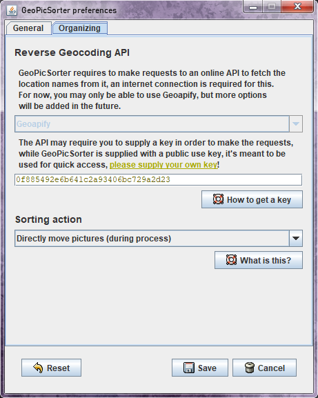
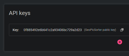
There's not really that much to do for now, but what you should consider doing is getting your own API key, it's an alphanumeric code (for example: 0f885492e6b641c2a93406bc729a2d23) required to interact with an online service that receives the latitude and longitude extracted from the pictures, and returned as a JSON string from which information can be extracted selectively. I use Geoapify for getting that information, but support for LocationIQ is also planned.
While GeoPicSorter includes a free key for everyone to use, it has a limited quota, and using it will lead to anyone not being able to use the tool for a time, you're encouraged to supply your own key because of this, and the key itself being free.

To sign up, simply go here or log in if you already have an account.

Once that's been taken care of and your account is ready for use, go to the projects page and click the Add a new project... button that shows up at the beginning. You'll be prompted to input a name, do so, confirm it, and...

You'll automatically be redirected to the page in which you manage your keys, and one will be ready for you. Click the Copy to clipboard icon that's next to the key.

Once you got the API key, paste it by double clicking on the current key that shows up in the home screen of GeoPicSorter then hitting Control + V, on that text field with the default key.
Finally, click the Use this key button, and you'll be set to organize pictures without any other user sharing it.